zzz – TWO ARTICLES

Assessment of the status of surface water bodies in the Czech Republic for 2019–2021

The article presents the results of the assessment of the status of surface water bodies in the Czech Republic for 2019 to 2021. The status assessment has been carried out by T. G. Masaryk Water Research Institute, p. r. i. (TGM WRI), Biology Centre CAS, and the Czech Hydrometeorological Institute (CHMI). The status of the water bodies was evaluated according to monitoring data from the River Boards state enterprises and – in the case of selected priority substances in biota – from the CHMI. The assessment procedures were the same as in the previous status assessment for 2016 to 2018, which was incorporated into the river basin management plans for the third planning period. The article focuses on presenting the results of the assessment, which was prepared by the TGM WRI. It is a summary assessment of the ecological and chemical status of water bodies, an evaluation of chemical and physico-chemical indicators and a comparison of the results of the assessment for 2019 to 2021 with the assessment for 2016 to 2018. In 2019 to 2021, good chemical status was not achieved in 57.6 % of water bodies; the problematic pollutants are mainly polyaromatic hydrocarbons; in the ‘biota’ matrix there was also mercury and brominated diphenyl ether. Good ecological status/potential has not been achieved in 92.3 % of water bodies; the problematic indicators are mainly biological quality elements and phosphorus.

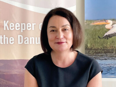
Interview with Mrs. Prof. Dr.-Ing. Birgit Vogel, ICPDR Executive Secretary

One of the biggest international activities in water protection is the multilateral cooperation in protecting the Danube. It originally started in the 1980s in the form of the Declaration signed in Bucharest in 1985, which concerned the Danube River itself. In 1992, at the initiative of the European Communities, the internationally supported Danube Environment Programme was launched, covering the entire Danube basin including its tributaries. In parallel, work was underway to prepare a Convention on Cooperation for the Protection and Sustainable Use of the Danube. The Convention was submitted for signature in Sofia on 29th June
1994 and entered into force on 22nd October 1998. The Contracting Parties to the Convention are Bosnia and Herzegovina, Bulgaria, Croatia, the Czech Republic, Germany, Hungary, Moldova, Slovakia, Slovenia, Serbia, Montenegro, Romania, Ukraine, and the European Union. In August 2022, for the first time, a woman became the Executive Secretary of the International Commission for the Protection of the Danube River (ICPDR) – Prof. Dr.-Ing. Birgit Vogel.

Disappeared pond system in the lower Doubrava river

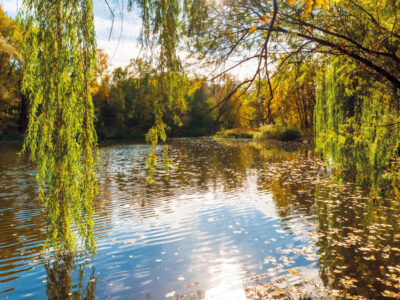
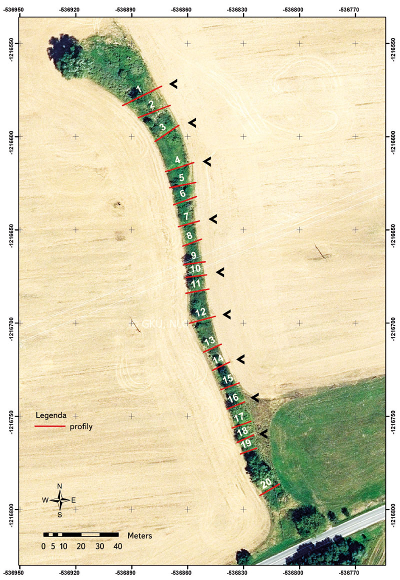
This article presents the results of research of the pond landscape development in the lower Doubrava river. The results are based on the interpretation of archival map documents and the current state of the site. On the map of the 1st military mapping (1764–1768), a system of thirteen ponds was recorded on the right bank of the Doubrava river. There were three ponds on the left bank of the Doubrava river. On the map of the 2nd military mapping (1836–1852), only four ponds were recorded on the right bank of the Doubrava river and only two ponds on the left bank of the Doubrava river. Of the historic pond system, only Koukalecký pond and a pond near Žehušice chateau have survived to the present day. On the 1st military mapping map, the total approximate area of the ponds was 449 ha, on the 2nd military mapping map it was 107 ha, and today only 0.91 ha.

Interview with Ing. Petr Kazda, Director of Partnership Environmental Foundation

Do you know Tree of the Year, Planting for the Future, and the Adapterra Awards? And do you know what an Open Garden is? Do you use Greenways? All this and much more is related to the Partnership Environmental Foundation in Brno, whose director since 2019 has been Ing. Petr Kazda. Why is climate change a challenge for him that can bring us new opportunities?

First experience with measurement of phosphorus retention in the Lhotsk stream using TASCC method

Eutrophication of watercourses and reservoirs, specifically the enormous phosphorus load on water, has been the biggest problem for water management in the Czech Republic for several decades. Budget models are effective support for rational solution; apart from resources, they must include the river network characterization, i.e. the retention of phosphorus in streams. A direct method for measuring phosphorus retention in watercourses under well-defined conditions, i.e. a method providing generalizable retention parameters, is fundamentally lacking and it could significantly increase the accuracy of the current models. It seems that TASCC method (Tracer Additions for Spiraling Curve Characterization) has such potential. In this article, we describe its first application in the Czech Republic, namely in the experimental basin of the Lhotsk stream (Beneov district).

Interview with Ing. Tomáš Fojtík, director of the T. G. Masaryk Water Research Institute

He has been Director of TGM WRI for a year. How does he evaluate this first year and what has he already managed to change for the better in our Institute? How does he remember his twenty years at the Institute as regular employee? And what are his plans and goals for the future regarding the direction of TGM WRI? „I would like to continue fulfilling my vision of creating a recognized and functioning institute of national and European importance as a research base for the field of water management with such a working culture and environment that it would be a target and prestigious workplace for quality and satisfied experts willing to actively cooperate,“ says the Director of our Institute, and newly also the president of the International Commission for the Protection of the Elbe, Ing. Tomá Fojtík.

Wastewater analysis as a tool for investigating drug abuse in education institutes

The wastewater based epidemiology (WBE) approach to wastewater has long been used for monitoring drug consumption, especially in urban agglomerations. In this pilot project, it was applied to detect drug use in selected educational establishments. The tests took place in both primary (age 6–15) and secondary schools (age 12–19). The focus was on illicit drugs (marijuana, methamphetamine, amphetamine, cocaine, and ecstasy), as well as the licit drug nicotine and its metabolites. Ephedrine was also monitored. Grab samples were taken before the start of classes between 7:30 and 8:05 a.m., and during the so-called big break, i.e., between 9:30 and 10:00 a.m., or 10:30–11:00 a.m.
Sampling was carried out on two dates, at the beginning of June and at the end of September/beginning of October 2022. There were positive find-ings for THC, ephedrine, methamphetamine and nicotine metabolites, primarily trans-3-hydroxy-cotinine. In accordance with the possibilities of the pilot project, the number of monitored schools was very small. In order to objectively determine the situation in educational facilities, it would be appropriate to monitor a more representative group, which would include, for example, vocational schools. It is also worth considering another method of sampling wastewater, e.g., several hours’ composite samples. However, in many educational institutions, this method may not be feasi-ble.

Interview with prof. Ing. Pavel Pech, CSc., professor at the Czech University of Life Sciences Prague

the future be over water rather than oil and land? Why is he more afraid of genes than climate change? And is it better to build dams and large water reservoirs, or establish ponds, wetlands, and pools? What is his opinion on artificial intelligence? These are just some of the topics that I discussed with prof. Ing. Pavel Pech, CSc., long-time head of the Department of Water Resources and Environmental Modeling at the Czech University of Life Sciences (CULS). “I’m from Hnojárna,”* he says about himself with a smile, and it does not sound pejorative at all – after all, he is the founder of the Faculty of Environmental Sciences at CULS in Prague.

Drought warning system and local threshold limits

Droughts and floods are extreme hydrological phenomena that are currently increasing in frequency due to the growing impact of climate change, and can have significant effects on our lives. Within the “PERUN” research project, an assessment of drought conditions and their development in the Czech Republic is being developed, along with the innovation of the warning system by the Czech Hydrometeorological Institute (CHMI). Drought is a natural phenomenon characterized by a gradual onset, long duration, and low dynamics, which requires a specific approach. The amendment to the Water Act introduces the obligation of regular reporting on drought and the establishment of a predictive service to be conducted by CHMI. Tools are being developed for long-term prediction of water resource conditions and a methodology for drought and water scarcity management plans. These plans aim to ensure water supply, protect the environment, and minimize the economic impacts. The decision-making body for issuing measures based on the drought plans is the Drought Commission, which operates at the regional level. The warning information is available on the HAMR web portal, which also displays local threshold limits for individual water resources.

Interview with RNDr. Radim Tolasz, Ph.D., climatologist of the Czech Hydrometeorological Institute

Today, one individual cannot quickly mitigate the current impact of climate change that the entire world is facing by changing their behaviour. However, the promotion and spread of education is one of the main keys to making positive changes in a significant part of the population. In an interview for VTEI, the Czech representative in the Intergovernmental Panel on Climate Change (IPCC), climatologist RNDr. Radim Tolasz, Ph.D., from the Czech Hydrometeorological Institute (CHMI), describes further steps to mitigate the effects of climate change or, for example, his own first professional experience after 1980.

Application for the parametrization and automatic running of the HEC-HMS rainfall-runoff model

This article presents an application developed in the Czech Hydrometeorological Institute (CHMI) to support hydrologic modelling using the HEC-HMS model as the primary used rainfall-runoff model. The application enables group editing of selected parameters of the model schematiza-tion, automatic running of simulations, display of selected simulation results, and communication of the HEC-HMS
model with GIS and other selected models, e.g., HEC-RAS or MIKE 11. The application is designed to use only freeware and open source libraries and is capable of operating under both Windows OS and UNIX/Linux OS. This article briefly describes the current state of the application devel-opment and its functionality, even for readers without major IT background. Further development is outlined in the last part of the article. Further development of the application is aimed at higher support for hydraulic modelling at the level of communication between the HEC-HMS and HEC-RAS models, as well as at the level of automatic parameterization and launching of the HEC-RAS model and its communication with other tools, e.g. hydraulic model MIKE 11 or GIS post-processing of the results.

Juvenile fish assemblages – appropriate tool for monitoring of the ecological status

Aquatic organisms have a very good ability to reflect the conditions of the environment they live in and, therefore, they are often used to assess the ecological status of that particular environment. of juvenile fish assemblages (0+) represent an appropriate tool for monitoring the ecological status of watercourses as they show a very rapid response to changes in environmental conditions. The goal of this study was to assess assemblages of juvenile fish (0+) at 22 sites across the Czech Republic between 2019 and 2021.

Interview with Mgr. Petr Hladík, Minister of the Environment

The Minister of the Environment wants to give people the opportunity to live in harmony with nature, and by that he does not mean just planting trees on city streets. Why does Petr Hladík call the Ministry of the Environment the Ministry of the Future? The use of rainwater, solar panels, and deposit PET bottles no longer have to represent an excessively progressive approach, but a standard for returning to our planet at least the minimum of what we take from it. Grey water subsidies? Why should we want it and what will we actually benefit from it? The new Minister of the Environment, Petr Hladík (KDU-ČSL), answers these questions for VTEI journal.

Landscape changes in selected locations of the Polabí lowlands with a focus on wetlands

This article presents three typologically different sites from Polabí where large-scale wetland sites were located in the past, including ponds. These sites were chosen in order to present disappeared floodplain meadows, disappeared “field” wetlands, disappeared ponds or pond systems, and, simultaneously, to present sites where wetland habitats have been at least partially restored. The main aim was to present easily accessible archival maps, on the basis of which it is possible to assess the spatio-temporal dynamics of wetland habitats in the places of disappeared wetlands with regard to their possible restoration.

Multi-Criteria Analysis of the Dyje basin

This article deals with applications of the specific method of multicriteria analysis (MCA) and its use in the identification of areas within the Czech Republic where adaptation measures to the consequences of climate change would be most effective. MCA was chosen due to its comprehensive approach and the simplicity of working with available data in the Czech Republic. The first MCA have already been applied in the Pilsen and Pardubice Regions within the framework of the creation of the strategic document Regional Strategy of Adaptation Measures (Regionální strategie adaptačních opatření, ReSAO), whose aim was to assess the vulnerability of the entire area of these regions. The results from both strategies are expedient from the point of view of drafting adaptation measures, and it was therefore decided to use MCA as part of a larger project in the Dyje basin. In the first phase, the implemented analyses were evaluated to improve MCA for the studied area. In the second phase, MCA was applied to the area of agricultural land. Several thematic indicators were evaluated, namely surface drainage, land use, erosion risk, and occurrence of erosion events. The aim was to focus on IV order basins, in which the priority of implementing measures on agricultural land is the highest. The result was a list of IV order basins with a partial and summary assessment of problems within the total studied area of the Dyje basin.
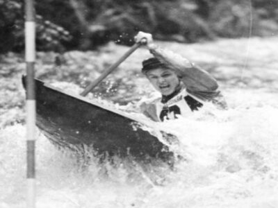
Interview with Jaroslav Pollert, professor at the Faculty of Civil Engineering at CTU and a successful Czechoslovak representative in canoeing

An interview with Jaroslav Pollert, professor of the Faculty of Civil Engineering at CTU and a successful Czechoslovak representative in canoeing, about his work as part of the Executive Committee of the International Canoeing Federation (ICF), the Czechoslovak and later the Czech Olympic Committee, about his professional career focused on the hydrodynamics of dispersion systems including, among other things, designing channels for water slalom and about his view on water management studies at Czech universities.

Irrigation – rediscovered heritage, its documentation, popularisation and protection based on the example of historical meadow irrigation systems

Objekty závlah byly budovány a fungují převážně jako součást většího nebo menšího funkčního celku. Jejich význam i z pohledu potenciální pa-mátkové ochrany tak roste s identifikací a dokumentací nejen solitérních staveb, ale zejména celých soustav/funkčních celků a popisem vazeb mezi nimi. Samostatný objekt či stavba nemusejí být nijak výjimečné, avšak jejich zapojení do většího funkčního celku může vytvářet unikátně pojaté řešení. V oboru vodního hospodářství se obzvlášť projevuje důležitost a význam kritérií, jako je hodnota typologická, hodnota technologického toku, autenticita formy a funkce, hodnota technologických a systémových vazeb s přesahem do zemědělství či průmyslu. Článek přináší informace o možnostech využití tradičních metod historického a archivního výzkumu a dokumentace lokalit, jakož i o využití moderních nástrojů pro plošně rozsáhlejší systémy, včetně metod digitalizace a digitálního zpracování podkladů.

Assessment of the possibility of changing the use of dry reservoirs

The main objective of the project „Potential use of dry reservoirs in landscape water management“ was to develop a methodological guideline describing the procedure for changing the use of a dry reservoir. The methodological guideline is based on a two¬ level multi¬criteria analysis. Another aim of the project was to make a complete record of implemented dry reservoirs and polders in the Czech Republic and to present it in the form of a database and a map with professional content. Documentation of the technical condition of some existing dry reservoirs was also an important output of the project.

River ferries on old topographic maps

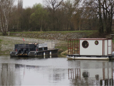
Medium and large rivers were a major obstacle to historic trade routes and trails. River ferries were one of the main ways to cross them, so their sites were considered points of strategic importance. Using old topographic maps from Austrian military mapping from 1763–1768, 1836–1852, 1876–1880, Prussian military maps from 1825 and 1877, and Czechoslovak military maps from 1953–1957, we systematically located ferries throughout the current territory of Czechia. Map keys from individual mappings were also analysed to examine how ferries are depicted on these maps. Based on the study of old topographic maps, a geographical database was created with the location of individual ferries, including the period in which the river ferry was registered. A total of 514 historical ferries were recorded on old topographic maps from military mapping throughout Czechia; another 28 ferries were identified from other available, more detailed, map sources.
A retrospective view of the Šumperk water supply system from the 1960s to the present

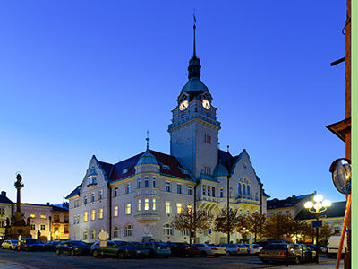
In the second half of the 20th century, the long-term problem of supplying the town of Šumperk with drinking water was finally solved. New sources of drinking water supplemented the missing capacities in the form of surface abstraction from Divoká Desná within the newly built collec-tive water supply system, together with the use of sources in Rapotín and Olšany. A significant contribution to solving the problem was the recon-struction of the water supply network, water reservoir, and intake facilities, which reduced losses. An important factor that has reduced the water consumption of the population is, of course, the significant increase in water and sewerage prices in the last 20 years, which had an impact on Šumperk as well. The operational and organizational conditions of the town’s drinking water supply were negatively affected by society-wide de-velopment, which ultimately meant an increase in operating losses in the water supply network due to limited funds for the renewal and upgrading of the water supply network. The political changes in 1989 and the following period were reflected not only in the organizational conditions of the town’s drinking water supply, but also in the final consumption and price of drinking water, both in the Šumperk region and across the whole of the Czech Republic. With the example of Šumperk, it is also possible to illustrate the transformation of the water industry after 1989 and possible diffi-culties, new starting points, and challenges for its future development.

Detection of gully erosion using the method of Global Navigation Satellite Systems in the Myjava – Turá Lúka

This paper shows the partial outcomes of a study focused on monitoring gully erosion in the Myjava river basin. The study showed the progress of dynamic changes in gully erosion in the location of Turá Lúka using various surveying techniques from 2014 until present. The study shows that selection of the surveying technique depends on various criteria and the aims of the task, where each possesses advantages and disadvantages. In the case of determination of the parameters of gully erosion (volume, length, and position), one of the suitable surveying techniques is Terrestrial Laser Scanning (TLS) as well as Unmanned Aerial Vehicles (UAV), which results in a point cloud. Measurement using Global Navigation Satellite Systems (GNSS) with a GPS device is sufficient for assessing gully erosion in transverse profiles, more complex sections, or in places with built anti-erosion and stabilization dams in a gully. This assumption was confirmed based on results from field measurements of an erosion gully by GNSS technology in 2017–2021. Evaluation of the results is given in this article. The given method of mapping the erosion gully was chosen for the need for detailed profile evaluation of previously identified critical sections (transverse profiles) of the monitored erosion form based on field surveying and area scanning and for simple data processing. The simplicity of this method due to the type of task, staffing, time, and volume of data predetermines and confirms the suitability of its selection for use under the given circumstances. When choosing this measuring technique, the requirements are easy access to the measuring point and a good satellite signal for GPS devices influencing the accuracy of the measurement concerning the surrounding vegetation. Sufficient testing and comparison of available surveying techniques make it possible to efficiently and realistically select suitable effective technology for monitoring erosive forms in the landscape for a predefined purpose. Contributions of this type will help researchers of similar tasks in decision-making when choosing the most suitable landscape surveying technology.

Possibilities of using spectroscopy for the evaluation of forest soil properties

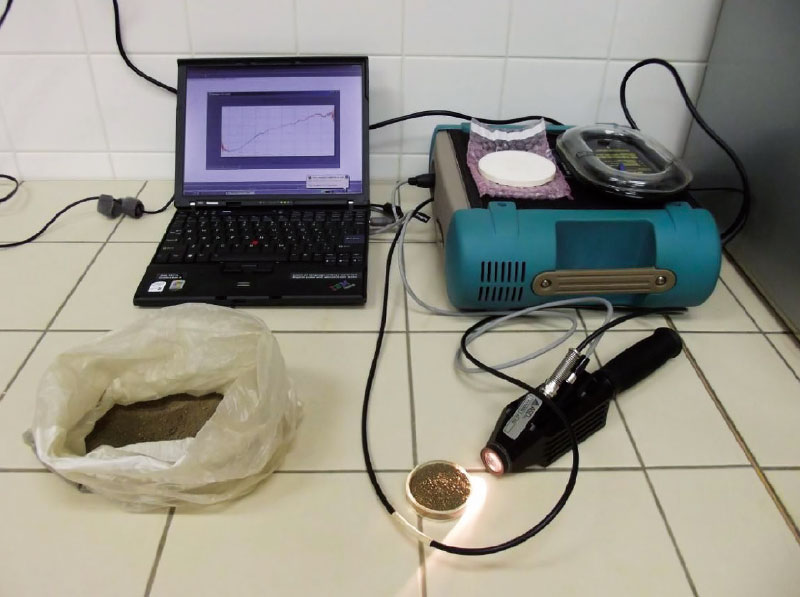
The aim of this study was an objective assessment of application of VNIR spectroscopy for predicting properties of forest soils. For each soil property were found the most appropriate combination of statistical methods for pre-processing (continuum removal, 1. derivation, 2. derivation) and processing (PLSR, PCR, SVM) of certain spectral bands. As generally successful shows a combination of methods 1. derivation and support vector machine throughout the VNIR spectral range (400–2 500 nm). In some cases, however, they proved to other models. Among the best predictable features include pH, content of oxidizable carbon, aluminum, iron, silicon, or calcium (at higher concentrations). Not very high success rate prediction was found in indicators that take low values (sodium, manganese, aluminum or ferrous complexes). The results show that VNIR spectroscopy method is applicable for predicting properties of forest soils. It can not completely replace traditional analysis, but it can very well complement, especially in practice. For example, when the soil mapping can help thicken network data and refine the information better than other methods of spatial estimation. It is applicable in cases where it is required large amounts of data in a short timeframe and at minimal cost. It is suitable for monitoring trends over time, or for a quick survey of an area.

Interview with Ing. Eva Juranová, head of the Department of Analysis and Assessment of Environmental Components at TGM WRI

This article is available in Czech only. For translation or more information on this topic, please contact author. Paní inženýrko, ve svém výzkumu se zaměřujete především na problematiku radioaktivity v životním prostředí. Bylo toto téma již od počátku v centru vaší badatelské pozornosti? Ano, dá se to tak říct. Ve VÚV TGM jsem jako čerstvý absolvent začínala… Read more »

Ash management in the circular economy of municipalities

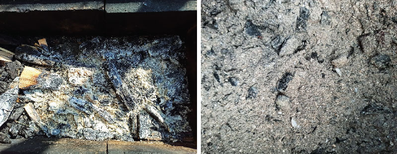
Ash from small heat sources is produced by burning solid fuels such as wood and coal. Based on a survey conducted by the article authors, ash from small heat sources can be considered the most significant waste stream in smaller municipalities in the Czech Republic. This material has considerable potential for reducing waste production, landfilling and consumption of primary raw materials.

Interview with Mrs. Heide Jekel, President of the International Commission for the Protection of the Elbe

The day you receive this issue of VTEI magazine, it rarely coincides with the date of the Magdeburg Seminar, organized by the International Commission for the Protection of the Elbe (ICPOL). We therefore take this opportunity to bring you a brief interview with the current President of this Commission, Mrs. Heide Jekel. You can find her biographical profile under the interview.

Grey water footprint of pollution discharged from wastewater treatment plants in the Czech Republic registered in the water balance in the period 2002–2018 – data set

Koncept vodní stopy byl představen v roce 2002 [1] a dnes je jedním z rozšířených nástrojů pro hodnocení udržitelnosti užívání vodních zdrojů [2]. Vodní stopa patří do rodiny environmentálních stop [3], které umožňují podívat se na problémy užívání přírodních zdrojů z jiné perspektivy. Šedá vodní stopa je kvalitativní ukazatel převádějící vypouštěné znečištění na objem vody potřebný k jeho naředění na koncentrace neškodné pro životní prostředí [4].

Education of water managers in Bohemia (and Moravia)

Ve vodařině se mezi odborníky i veřejností často diskutuje o suchu, povodních, kvalitě vody ke koupání, o zajištění zásobování pitné vody atd., a to vždy podle toho, co zrovna nastane. Je však stejná pozornost věnována například zajištění další generace českých vodohospodářů? Dokáže současný mediální pohled na vodní hospodářství přitáhnout mladé studenty k vodohospodářským oborům? Měl jsem možnost si na toto téma popovídat s panem doc. dr. Ing. Pavlem Fošumpaurem, zástupcem vedoucího katedry hydrotechniky Fakulty stavební ČVUT v Praze.

Quantification of rill erosion using contactless methods

S překotným vývojem v oblasti geoinformačních a komunikačních technologií se objevují nové možnosti mapování a kvantifikace erozních procesů způsobených přívalovými srážkami. Pro získání relevantních výsledků je důležitá kvalita, hustota a rozsah vstupních dat. Rychlý a poměrně levný sběr přesných geodat umožňují bezpilotní letecké prostředky (UAV – z anglického Unmanned Aerial Vehicle). S využitím metod digitální fotogrammetrie je možné z pořízených leteckých snímků rekonstruovat morfologii terénu odpovídající času měření.

1 Rozhovor s Ing. Zbyňkem Folkem, generálním ředitelem státního podniku Povodí Ohře

Generálním ředitelem státního podniku Povodí Ohře jste se stal v květnu 2019. Po vašem nástupu do funkce v něm došlo k řadě změn. Které z nich byste označil za největší a jaké cíle si kladete do dalších let? Státní podnik Povodí Ohře jsem přebral v uspokojivém stavu, odborná úroveň zaměstnanců ve všech oblastech je dobrá, zejména co se týče vodohospodářské problematiky, podnik… Read more »

Adaptation of towns and municipalities to floods and drought

This article is available in Czech only. For translation or more information on this topic, please contact author.   Souhrn Realizace komplexních adaptačních opatření je v posledních letech významným trendem ve všech velkých městech a obcích Evropy. Potřeba přizpůsobení se změně klimatu, vyznačující se střídáním krátkých a intenzivních povodňových epizod [1] a dlouhých období sucha,… Read more »

Groundwater formation in urban areas regarding peripheral parts of Prague

Groundwater is an integral part of the hydrosphere and hydrological cycle in a healthy landscape, which is better able to withstand hydrological extremes such as floods or prolonged drought. The main source of groundwater is precipitation. There are a number of barriers for infiltration in urban areas – urban and industrial buildings, as well as increasing areas with impermeable surfaces. The aim of the paper is to draw attention to the importance of groundwater in the urban landscape and to possible measures to support the infiltration of precipitation.
The research took place in the territory of outer Prague, where there is an intensive expansion of the built-up area, which is accompanied by a lower infiltration of precipitation, compared to the open landscape. Based on the evaluation of pedological, geological and hydrogeological conditions of the area, a methodology for evaluating the suitability of the area for infiltration was developed. Based on it, two types of maps were created: an infiltration potential map evaluating primarily the permeability of the soil and rock environment, and an infiltration capacity map, in addition emphasizing the size of the free storage volume for infiltrated water. Maps are available for viewing in the map application on the project website heis.vuv.cz/projekty/praha-adaptacniopatreni.

Project CZ.07.1.02/0.0/0.0/16_040/0000380 “Analysis of adaptation measures to mitigate impacts of climate change and urbanization on the water regime in the area of external Prague”

 This article is available in Czech only. For translation or more information on this topic, please contact author. Rádi bychom vás seznámili se základními údaji o projektu, který byl řešen v období 2018–2020 v rámci operačního programu Praha – pól růstu. Za tímto textem jsou pak uvedeny články zabývající se již specifickými tématy, jež byla… Read more »

Monitoring of the coronavirus SARS-CoV-2 in wastewater – what the monitoring has shown us so far and where it is headed

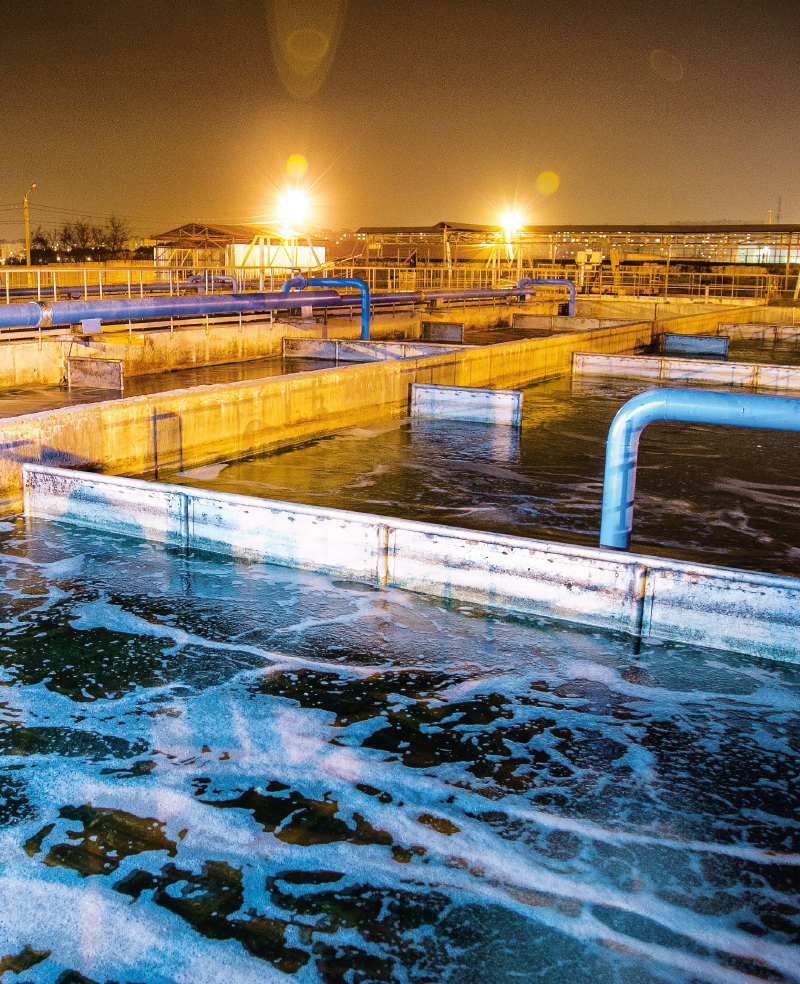
Since April 2020, the presence of the coronavirus SARS-CoV-2 in wastewater has been monitored at TGM WRI, p.r.i. The method of detection is similar to that of clinical samples, ie the presence of a specific fragment of viral RNA is detected by PCR.