zzz – MAIN ARTICLE

Groundwater abstraction noticeably reduces the flow of some watercourses during the dry season

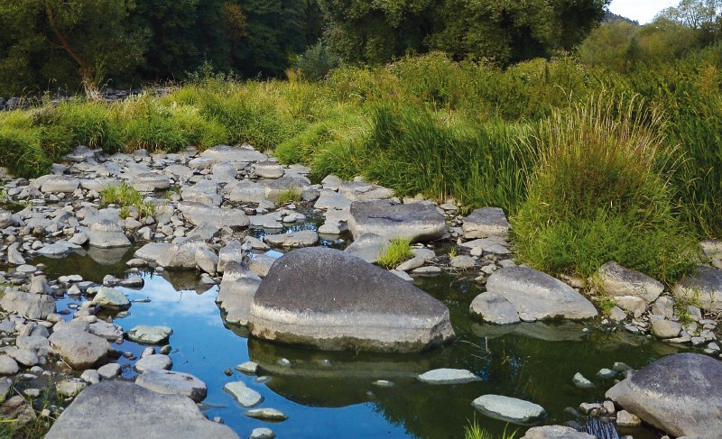
The paper highlights the fact that some significant watercourses dry up during periods of minimal flows due to groundwater abstraction. It provides a summary of the most affected significant watercourses in the Czech Republic. Large concentrated groundwater abstraction has a considerable impact on small and medium-sized watercourses. To select the most significant effects of abstraction on stream flows, we used the ratio of abstraction to 355-day flows from 1931–1960. Watercourses exceeding 30 % were selected. In half of the selected cases the following relationship was confirmed: the 355-day flow from 1931–1960, reduced by the abstraction rate, is approximately equal to the 355-day flow from 1991–2020. The cases where this relationship does not apply can be explained by changes in abstraction volumes, declining groundwater levels and flows in the wider area due to groundwater collection and the use of static groundwater reserves. The effect of climate change is unlikely to be present in the baseflow in the cases studied. Our analysis identified 13 cases where groundwater abstraction is severely affecting the flow of significant watercourses. In about half of these cases, there is an alternative source of water that should be used when the flow of the watercourse is at a minimum. Another option to protect water resources is to apply the minimum groundwater level or minimum residual flow under the Water Act.

Development in and status of surface waters in an important drinking water source area

The paper discusses changes in of the basic parameters of surface water within the important drinking water source area of hydrogeological unit 232 Ústecká syncline, in the Svitava river basin. Emphasis is placed on the changes in the amount of water in the Svitava river and the changes in the basic physical and chemical parameters of these waters. The possible effect on local groundwater, which is intensively used for drinking purposes, is discussed. The contribution compares historical data sets with the results of current monitoring within the project SS06010044 (PPŽ VI, TA CR). The current qualitative state of surface water points to caution in promoting direct infiltration into groundwater due to the risk of contamination.

Fishponds as an element of surface waters network – overview, history, function

Historically, fishponds are a part of our landscape and Christmas carp is also a part of our culture. This paper describes the history of fishpond management and the different functions of fishponds – the development of fish production as food, the influence on quality of surface waters, the influence on climate and on hydrological regime of the landscape, and the issue of fishpond sediments – their removal and further use. As there is no general pond register in the Czech Republic, so (as part of the DivLand project) we created the Map of water bodies and fishponds in Czech Republic, based on the ZABAGED (primary base of geographical data
in the Czech Republic). For water bodies with an area over 1.0 ha, a public database (xls) was created; bodies over 5.0 ha were classified into groups (fishponds, reservoirs, flooded areas, lakes). The database also contains accessible data on the quality of fishpond sediments. Fishpond sediments are a favourable material for improving the quality of agricultural soils; problems with their use are mostly technical and economical.

Comparison of the quality of thalweg lines extracted from data of DMR 4G, DMR 5G and its derivatives

Determining the gradient of watercourses in the case of local applications is a common problem, which is most often dealt with by geodetic surveying. However, determining the gradient of all watercourses in the Czech Republic is a challenge. The use of geodetic methods on such a scale is usually unrealistic. Therefore, it is necessary to choose a different approach, such as the extraction of the gradient lines from other already existing elevation data. The DMR 4G and DMR 5G are elevation models currently available for the Czech Republic. For the extraction of gradient lines, it is necessary to create a digital terrain model (DTM) from the available datasets. Various interpolation methods are used for this. But which of the available interpolation methods is the most suitable? What role does the size of spatial resolution play in the quality of altimetry representation and subsequent sizes of the stored DTMs? To find answers to these questions, we chose four study sites (fourth order catchments) in the Otava river basin. Eight different DTMs were then created at each site, which were then compared. The results show that choice of raster size has a significantly greater influence on the resulting quality of the gradient lines than the choice of interpolation method in the case of DTM creation from DMR 5G data. DTM from DMR 4G data gives worse results than from DMR 5G at the same raster resolution.

Benefits and risks of using sludge from small WWTPs after processing by composting for the production of selected types of vegetables

The aim of the study, the results of which are presented in this article, was to assess the possibility of simplifying treatment and stabilisation procedures of sewage sludge from small municipal sources of pollution (domestic and small WWTPs up to about 1,000 EP) at the place of their origin and their subsequent use through extensive composting. The results demonstrated the benefit of the application of composts from a material base containing sludge from small WWTPs in increasing the production of the monitored types of vegetables. However, especially with lettuce, there was a higher transmission of selected risk elements. We therefore do not recommend the use of composts with sludge for growing leafy green vegetables. In contrast, this risk did not arise with fruit and vegetables. For practical use, it is still necessary to assess the rate of transfer of other pollutants, such as drug residues and microplastics.

Possibilities of wastewater treatment using an experimental device for physical action by an electrostatic field with a focus on pharmaceuticals

As a result of climate change and the world´s population growth, ensuring sufficient amount of water is expected to be an increasing problem. There is a growing need for eco-technologies with reduced water consumption, for the use of harvested rainwater, as well as reuse of wastewater.
Currently there are millions of known chemicals, and more and more are being synthesized every day. The chemization of various branches of industry leads to the increasing massive contamination of our environment with foreign substances.
This paper presents the possibilities of rebuilding experimental laboratory equipment for the physical processing of waste into an equipment able to apply electrostatic field action on wastewater. It also considers the possibilities and perspectives of its further use, either alone or in combination with other technological processes, e.g. biotechnologies. The first series of experimental trials was aimed at eliminating selected pharmaceuticals.

Direct monitoring of water vapor from the free water level of the Vavřinecký pond and its influence on the hydrological balance

With increased average air temperature, there is an increase in water vapour from a water surface. Between 2020 and 2022, evaporation from the water surface was observed with a floating evaporimeter at Vavřinecký pond in the Central Bohemian region. A floating evaporimeter monitors evaporation from the water surface along with basic meteorological quantities directly on the surface of the water reservoir, so its results should be more accurate than calculations based on data from nearby meteorological stations. The results show that in all three years evaporation exceeded precipitation by more than 100 mm between April and September. However, the issue of the influence of small water reservoirs on the hydrological balance is a very complex topic, where the assessment of negative and positive effects is not always black and white and requires detailed investiga-tion.

The influence of wastewater on microbial contamination of the Vltava below Prague

In terms of public health protection, the most important indicator in surface water monitoring is microbial fecal contamination. Despite the introduc-tion of the best available technologies, their biggest source is treated and untreated municipal wastewater. Around 90 % of the Czech population use their local sewerage system, which is linked to a WWTP, treated, and discharged into recipient waters. Monitoring of microbial contamination of the Vltava below Prague CWWTP showed a level of fecal pollution in the 10 km section below the wastewater inflow in periods with different flow rates. Smaller tributaries of the Vltava, which bring treated wastewater from local WWTPs to the Vltava, were monitored as additional sources. From April 2022 to March 2023, the amount of Escherichia coli, enterococci, thermotolerant coliform bacteria, and Clostridium perfringens were monitored at ten sampling sites. The monitoring results showed relatively significant microbial pollution of the Vltava from Prague CWWTP dis-charge and, at the same time, the river’s substantial self-cleaning ability in the following section. This creates good potential for the river’s future utilization in the monitored area, with the exception of the section directly affected by the inflow of treated wastewater from Prague CWWTP. This study could be used to raise public awareness in order to minimize the health risk caused by the river’s inappropriate utilization (possible presence of pathogenic microorganisms, including carriers of antimicrobial resistance).

Assessment of trends in concentrations of chemical and physico-chemical indicators of the status of surface water bodies

This article presents the results of trend assessment of selected chemical and physicochemical indicators of surface water status. The assessment approach is based on a similar procedure for assessing significant upward trends of pollutants and trend reversals in groundwater bodies. The procedure is based on measured concentrations from 2010 to 2018 and estimates concentrations at the end of 2021, 2024, and 2027. For the trend assessment, data from Czech river basin state enterprises were used to assess the ecological status/potential and the chemical status of surface water bodies. However, only part of the profiles with measured concentrations met the time series requirements. The assessment of trends towards the end of 2024 and 2027 shows that some indicators (polyaromatic hydrocarbons, adsorbable organically bound halogens – AOX, and nitrate nitrogen) are projected to improve compared to the status as of 2018. On the other hand, a slight deterioration is predicted for biochemical oxygen demand, dissolved nickel, and ammonia nitrogen.

Radioactive indicators in surface waters of the Ploučnice river basin

The Czech Hydrometeorological Institute (CHMI) is engaged in systematic monitoring and evaluation of radiological indicators in surface waters. The article describes changes in the values of radiological indicators in surface waters in the time series from 1967 to the present. The evolution of total volume alpha and beta activity, uranium concentration, and radium activity (226Ra) is described on characteristic profiles in the area of uranium-containing raw materials mining, in the vicinity of Stráž pod Ralskem, where the mining of radioactive raw materials has already been suppressed. The Ploučnice river flows through this mining area and flows into the Elbe river in Děčín near the Hřensko border crossing, where activities of radiological indicators are also monitored and documented. Following the cessation of uranium mining at the Stráž pod Ralskem deposit, uranium concentrations dropped by two orders of magnitude, and surface waters on the Ploučnice – Mimoň profile have been classified as Class I – unpolluted water for the last five years. The values of Kendall’s correlation coefficient τ for the profiles evaluated on the selected profiles during the mining period are characterized by an increasing trend (+0.7) for the indicator of total volume beta activity; after the end of mining, a decreasing trend is indicated (-0.5).

Dynamics of micropollutant loads into water supply reservoirs Vír I, Opatovice and Ludkovice

Pesticides are still an important group of substances involved in surface water pollution. Their increased occurrence in watercourses in the agricultural landscape is mainly linked to rainfall-runoff conditions, types of cultivated crops, and methods of agricultural management. In order to capture these factors, passive sampling techniques were chosen for the assessment of the load of these substances in selected catchments of water supply reservoirs in the administration of Povodí Moravy State Enterprise. These techniques consist of continuous exposure for several weeks with gradual (integrative) capture of pollution on suitable sorbents. The POCIS (polar organic chemical integrative samplers) were chosen in this work – widely used samplers suitable for capturing polar organic substances. They were applied in eight consecutive sampling campaigns to cover the entire growing season. The aim was to assess the spatio-temporal dynamics (in monthly steps) of selected pesticides and their metabolites into five water supply reservoirs. Due to the scope of the obtained data, this article is focused on the presentation of the results of tributaries into water supply reservoirs Vír I, Opatovice, and Ludkovice, which were monitored in 2021. When the sampling rate Rs was published, it was possible to recalculate the pollution captured by the passive sampler to average concentration during exposure. The results showed which tributaries into the reservoirs were loaded by these hazardous substances in the individual periods of the growing season. The results can be compared with the type of crops grown in a given year.

Presentation of some of the results of a research project mapping the development of the construction of elevated water tanks in the Czech Republic

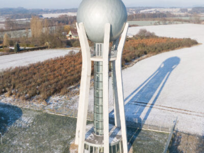
This paper presents a summary of some of the results of the research project, “Water towers – identification, documentation, presentation, new utilization”, (DG18P02OVV010), which has been implemented since 2018 as part of the Programme for the Support of applied Research and Development of  National and Cultural Identity for 2016–2022 (NAKI II) of  the Ministry of  Culture of the Czech Republic. In terms of content, it follows on from articles from previous years published in this periodical, but clarifies and supplements the issues of technical terminology and typology established at its inception based 
on the knowledge gained during the project. Furthermore, it presents general results of the records of the structures of elevated water tanks and focuses on a brief description of the historical development of these structures in our territory. 

Estimation of natural groundwater resources in hydrogeological zones in the Czech Republic under changing climatic conditions 1981–2019

In the Czech Republic, hydrogeological zones were defined as early as 1965 as a part of the regional hydrogeological survey. A hydrogeological zone (HGZ) is defined as a unit with similar hydrogeological conditions, defined tectonically and geologically, in whose territory a certain type of aquifer and groundwater circulation prevails. The boundaries of HGZs have been modified over time and their numerical hydrogeological characteristics have been determined by various methods; one of the basic characteristics is the amount of natural groundwater resources. Natural resources are the dynamic component of groundwater and are expressed in m3.s-1. They are determined by the recharge of water to the aquifer system (precipitation, groundwater overflows from other aquifers, natural infiltration of surface water, etc.). If the HGZ is hydrogeologically closed, the long-term average of its recharge from precipitation and the long-term average of baseflow can be used as an estimate of the natural groundwater resource. In the “Groundwater Rebalance Project”, estimates of natural groundwater resources in 152 hydrogeological zones in the Czech Republic were processed and are presented in the report [1]. The natural resources were determined by several different methods using data from 1971–2010 and 2000–2010. 

Bacteria from the family Enterobacteriaceae in reused water and their antibiotic susceptibility

The aim of this study is to evaluate the presence of bacteria from the Enterobacteriaceae family (i.e. total coliforms, thermotolerant coliforms and Escherichia coli) in different types of recycled waters (grey water, rain water and reclaimed water from the public city fountains) and problems with their detection (especially ensitivity and specificity of detection methods). The species composition of coliform bacteria in purified grey waters with their antibiotic resistance are presented.

The influence of Prague on water quality in the Vltava and the Czech Elbe

Paper deals with the development of water quality of the river stretch of Elbe between the confluence Elbe/Vltava and the Hřensko/Schmilka on the frontier Czech Republic/Federal Republic of Germany in the period 1980–2020 and with the influence of Prague City on its pollution. After the significant improvement in the period 1985–2000, the quality of water discharged through the profile Hřensko generally complies with the German level at least. Assessment of the transport budgets shows that Vltava river contributes more to the system only as having higher water discharges. Prague City contributes to the pollution of Vltava and Elbe only by discharge of phosphorus, for the rest of common pollution items it functions only as a non-significant source.

Use of SARS-CoV-2 virus monitoring in wastewater from WWTP of various categories for epidemic surveillance in the Czech Republic

The principle of wastewater diagnostics is a suitable complementary approach that can help to gain epidemiological information on a large part of the population in a non-invasive way. The course of the pandemic spread of the new coronavirus (SARS-CoV-2) has been showing a cyclical course of successive waves of Covid-19 since 2020. For this model, a systematic detection of the occurrence of its agent in wastewater is a very effective approach.

Automatic watershed delineatiom in Czech republic using ArcGIS Pro

Manual watershed delineation by watershed divides has traditionally been performed by means of an analysis of topographic maps and contour lines. With the availability of digital elevation models, watershed and streams delineation is performed automatically, which reduces the time spent on manual delineation. In this study, we introduce the process of automatic delineation and the models available within the toolbox Arc Hydro Tool Pro, created by the company ESRI for the ArcGIS Pro software. Automatic delineation was implemented by means of different methods for selected watersheds in the Czech Republic, varying in area and elevation.

Vertical distribution of radioactive caesium-137 in soil

In the past, the environment of the Czech Republic was contaminated with anthropogenic radionuclides as a result of atmospheric nuclear weapon testing and the Chernobyl accident. The paper summarises results of vertical migration of 137Cs in soil in selected sites, performed as part of collecting data for ground water vulnerability assessment. Three sites with a different land cover were included (forest, meadow and arable land). In order to determine vertical migration of anthropogenic radionuclides, soil samples were collected up to the depth of 100 cm and subsequently analysed using the gamma-ray spectrometry.

Water quality and state of aquatic invertebrate populations in small watercourses in Prague

The aim of this paper has been to evaluate the ecological status of small watercourses in the capital city of Prague by analogy to the evaluation of water bodies pursuant to Directive 2000/60/EC. A total of eight sites were selected at seven watercourses (Šárecký, Dalejský, Radotínský, Libušský, Kunratický, Botič and Rokytka Streams). Both sections that are semi-natural and those that have been restored in various ways were selected. From May 2017 onwards, annual sampling of chemical indicators took place in selected sites and a standard multihabitat method was used to take samples of aquatic invertebrates (macrozoobenthos).

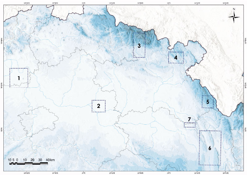
Drought in the Upper Metuje Basin in 2014–2019

In the years 2014–2019, there was a historic drought in the Czech Republic. The Department of Hydrology and Hydrogeology of the T. G. Masaryk Water Research Institute has been carrying out long-term hydrological and hydrogeological observations in the upper Metuje basin where this drought manifested itself significantly. The upper part of the catchment area of the Metuje River is located in the Police Cretaceous basin geological formation.

Preservation of drinking water demand from water reservoirs in climate change conditions

This study presents interim results of an evaluation of a potential climate change impact on the preservation of drinking water demand provided by water reservoirs in the timeframe of the year 2050. Hydrological and water sources and demands balance procedures have been applied, including modelling of the storage ability of water resources and water supply systems.

History and future development of rainfall-runoff characteristics on the outskirts of Prague

This article is available in Czech only. For translation or more information on this topic, please contact author.   Souhrn Tento příspěvek prezentuje studii vývoje srážkoodtokových charakteristik v šesti povodích na okraji Prahy od roku 1920 s výhledem do roku 2050. Kvůli neexistujícímu dlouhodobému monitoringu bylo hodnocení provedeno prostřednictvím srážkoodtokového modelování v prostředí HEC-HMS. Klíčovým… Read more »

Change of microbial community in tertiary wastewater treatment

The aim of this contribution is the presentation of partial results of testing tertiary technology for recycling of treated urban wastewater. The obtain water will be used for watering of greenery, playgrounds, or for street cleaning. The quality of the treated water depends on the purpose of the use.

Study on the assessment of the effect of nature-friendly measures in the Olešná in Pelhřimov catchment area using the BILAN, HEC-HMS and HYPE models

A catalogue of natural restoration measures was created within several research programs under Ministry of the Environment of the Czech Republic, especially in the program for hydrological draught mitigation. As a next step suitable catchments for their application were identified. With use of hydrological models, the effect of designed restoration measures on three aspects of hydrological regime was assessed.