Hydraulics, hydrology and hydrogeology

HYMOD-KZ database and deficit areas

This article describes the HYMOD-KZ database, available at https://shiny.vuv.cz/HYMOD-KZ/. The database provides detailed results of hydrological modelling and hydrological balance analysis of catchments (water bodies) for current and future climate conditions; it also includes updated deficit areas, the description of which is part of this article. This tool can serve as a foundation for water management ex-perts, academia, and the broader professional community as it provides outputs at the spatial resolution of water bodies. The graphical rep-resentation of results facilitates understanding of complex hydrological phenomena and supports decision-making in water management planning.

Tools for risk assessment of catchment areas for abstraction points of water intended for human consumption

In December 2020, the new EU Directive 2020/2184 on the quality of water intended for human consumption was published. This Directive places a strong emphasis on comprehensive protection of water resources and introduces an obligation to carry out risk assessment and risk management of the catchment areas for abstraction points of water intended for human consumption, compared to the previous Directive from 1998. The risk analysis of the catchment areas must be carried out for all water abstractions for drinking purposes that abstract more than 10 m3 raw water per day. In the Czech Republic, this concerns approximately 3,650 abstractions (of which about 3,500 are groundwater abstractions and about 150 surface water abstractions). On a nationwide scale, it is therefore a considerable amount of risk analyses of parts of the catchment areas, which, according to the Directive, must be performed by 2027. The main aim of the project “Tools for risk assess-ment of catchment areas for abstraction points of water intended for human consumption” (supported by the Technology Agency of the Czech Republic) is to develop a methodology for the preparation of this risk analysis of the catchment areas. In order to ensure that the risk analyses of the catchment areas to be prepared by different entities have a uniform form and structure, a form (mock-up) of what the risk analyses of the catchment areas should look like and what they should contain has been developed within the framework of the methodology. As this is a very complex issue, only the main skeleton of the methodology will be presented in this article, focusing on the basic characteristics of the abstraction and the definition of the area (the catchment areas) in which the risk activities for the quality of the abstracted raw water are determined.

Future water demand scenarios to 2050: sectoral analyses and forecasts

This article presents the results of the sub-objective “Scenarios of future water demands for different climate scenarios and individual sec-tors of water use” (DC 1.1). Which is part of TA CR project No. SS02030027 “Water systems and water management in the Czech Republic and climate change conditions (Water Centre)” and is a sub-part of the WP 1 “Prediction of the development of water resources security in the Czech Republic until 2050 in regions depending on climate change”.

Groundwater abstraction noticeably reduces the flow of some watercourses during the dry season

The paper highlights the fact that some significant watercourses dry up during periods of minimal flows due to groundwater abstraction. It provides a summary of the most affected significant watercourses in the Czech Republic. Large concentrated groundwater abstraction has a considerable impact on small and medium-sized watercourses. To select the most significant effects of abstraction on stream flows, we used the ratio of abstraction to 355-day flows from 1931–1960. Watercourses exceeding 30 % were selected. In half of the selected cases the following relationship was confirmed: the 355-day flow from 1931–1960, reduced by the abstraction rate, is approximately equal to the 355-day flow from 1991–2020. The cases where this relationship does not apply can be explained by changes in abstraction volumes, declining groundwater levels and flows in the wider area due to groundwater collection and the use of static groundwater reserves. The effect of climate change is unlikely to be present in the baseflow in the cases studied. Our analysis identified 13 cases where groundwater abstraction is severely affecting the flow of significant watercourses. In about half of these cases, there is an alternative source of water that should be used when the flow of the watercourse is at a minimum. Another option to protect water resources is to apply the minimum groundwater level or minimum residual flow under the Water Act.

Influence of retention curve parameter α on capillary barrier efficiency

This study is focused on the calculation of parameter α of the wetting branch of the retention curve and on the influence of its value on the efficiency of capillary barriers. The capillary barrier is a simple method of insulating landfills. The effectiveness of the capillary barriers was tested using numerical models, which allow greater testing variability compared to physical measurement. Thanks to numerical models, it was possible to evaluate the direct effect of changing the parameters of retention curves on the functioning of capillary barriers. Hysteresis of retention curves was included in the construction of the numerical models, and then its effect on the agreement of the model results with the measured data was evaluated. Numerical modelling is a suitable and reliable tool for verifying the efficiency of capillary barriers. Due to the sensitivity of the results to the parameters of the task, it is necessary to determine as precisely as possible all the necessary input parameters so that the resulting model has real informative value.

Old groundwater in hydrogeological regions 4410 and 4522

The article presents a project from the Technology Agency of the Czech Republic dealing with the hydrogeology of old waters in hydrogeological regions 4410 and 4522. The aim of the paper is to present a brief hydrogeological characterization of the area of interest, to present the results after the first year of the project, and to describe the uncertainties of existing information. Old groundwaters that have negligible concentrations of tritium can be considered a strategic resource because they are less susceptible to current contamination.

Methodology for creating a Map of the Vulnerability of the Quantity of Natural Groundwater Resources to Drought for the Czech Republic

Groundwater drought affecting groundwater availability is still mostly understood as a subset of hydrological drought. The impact of hydrological drought on groundwater is manifested with a delay and depends on its duration. An expert interactive Map of the Vulnerability of the Quantity of Dynamic Groundwater Resources to Drought for the Czech Republic was created as part of the TA CR project SS01010208 – “Controlled Groundwater Recharge as a Tool to Reduce the Impacts of Drought in the Czech Republic”. The presented vulnerability map is created on the basis of the use of precipitation normal and regression relationships between precipitation and total runoff and groundwater discharge (base flow) using the Base Flow Index (BFI) and ratio of base flow in the driest year of 2010–2019 to the long-term average of base flow (M index), which guarantees uniform processing for the entire Czech Republic at a scale of 1 : 50,000 and an objective comparison of the vulnerability of dynamic groundwater resources to drought throughout the country. It is also based on recorded groundwater abstraction and in the case of municipalities with individual supply, the abstraction is calculated from the number of inhabitants and the national average consumption of drinking water per capita. The Map is compiled based on the balance of dynamic groundwater resources and groundwater abstraction. It contains six categories and shows which regions and areas will struggle to have sufficient groundwater resources during periods of prolonged drought. It synthesizes all available flow logs and other data until 2020 and is designed so that the layers with variable information can be updated in the future.

Interview with doc. RNDr. Zbyněk Hrkal, CSc., hydrogeologist, writer, and populariser of water management

The October issue of the VTEI journal deals mainly with groundwater and its management. We therefore discussed the promotion of this topic with a colleague who is engaged in research in groundwater, has been lecturing on hydrogeology
for a long time at the Faculty of Science, Charles University in Prague, and deals with the topic of water management in his publications. “The main problem in the world is not a physical lack of water, but poverty, illiteracy, and economic backwardness,” says Zbyněk Hrkal.

Danube Regional Water Lighthouse

Accessible and high-quality water is a natural resource essential for life, well-being, and social prosperity. After decades of intensive exploitation, pollution and socio-economic pressure, Europe’s freshwaters and seas are at risk of degradation. This has to be seen not only as a potential dramatic loss from an economic point of view, but also it means unpredictable ecological, social, and cultural damage. The European Commission has responded to this challenge by creating the research and innovation mission Restore our oceans and waters; with a 2030 target, the aim is to provide a systemic approach for the restoration, protection and conservation of oceans and freshwater. In 2022–2025, a development and pilot phase has been underway, during which four so-called Mission Lighthouses were launched. “The Danube Regional Water Lighthouse Action” (DALIA) aims to significantly contribute to the improvement of the state of the Danube basin; it is financed by the European Union under the Horizon Europe programme with a total subsidy of € 8,499,236. The basin is home to almost 80 million people and extends over 19 European countries, which is exceptional even on a global scale.

Hydrogeological aspects of boreholes for heat pumps

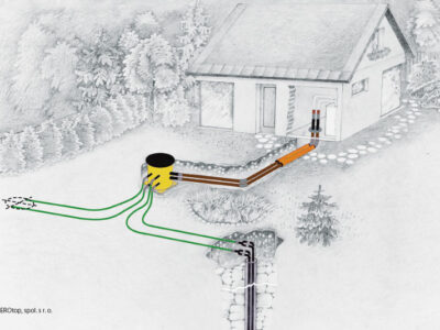
In recent years, there have been significant legislative and methodological changes in the construction and use of geothermal heat pumps (GHP), also known as ground-source heat pumps (GSHPs). The use of GHP has become a widespread
solution for heating buildings of all kinds, from family homes to industrial buildings. This article concerns GHP (ground-to-water and water-to-water types) that use shallow geothermal energy, obtained mainly through boreholes.

Development in and status of surface waters in an important drinking water source area

The paper discusses changes in of the basic parameters of surface water within the important drinking water source area of hydrogeological unit 232 Ústecká syncline, in the Svitava river basin. Emphasis is placed on the changes in the amount of water in the Svitava river and the changes in the basic physical and chemical parameters of these waters. The possible effect on local groundwater, which is intensively used for drinking purposes, is discussed. The contribution compares historical data sets with the results of current monitoring within the project SS06010044 (PPŽ VI, TA CR). The current qualitative state of surface water points to caution in promoting direct infiltration into groundwater due to the risk of contamination.

Interpolation of selected discharge rates in ungauged fourth-order catchments in the Otava basin

Knowledge of catchment runoff values is the key to a wide range of engineering and scientific applications. However, direct measurements in the scope of all fourth-order catchments in the Czech Republic are not realistic. Standard methods for estimating these parameters are local regression models, rainfall-runoff models, or other interpolation techniques. Regression models provide reliable results, but the derivation of local regression equations is demanding on the amount of input and reference data. Rainfall-runoff models have their application in design activities at a local scale. Their application in the Czech Republic is not trivial and requires knowledge of precipitation distribution. Interpolation techniques provide a fast but often less reliable approach. Most of these interpolations are not primarily intended for hydrological applications; the exception is the Top-Kriging method.

New watersheds for first to fourth order catchment areas

Watershed or catchment area are used as basic input data for a whole range of water management-oriented activities, whether it is rainfall-runoff modelling, calculation of the water management balance, preparation of flood plans, or the use of watersheds as one of the data sources for spatial analysis. A catchment area, defined by its watershed, is also a necessary basis for deriving standard and non-standard hydrological data according to the standard ČSN 75 1400 Hydrological data of surface waters [1] and, at the same time, is the basic spatial unit used in hydrological practice. The definition of a catchment is enshrined in Act No. 254/2001 Coll. (hereinafter referred to as the Water Act) [2], where a catchment is an area from which all surface runoff flows into the sea through a network of watercourses and possibly lakes. A sub-catchment is an area from which all surface runoff flows through a network of watercourses and lakes to a certain point in the watercourse, which is usually a lake or a river confluence. According to decree 252/2013 Coll. [3], hydrological catchments are registered in the form of a polygon based on data from their numerical identifier and the size of the area and are determined on the basis of the hydrological structure of water channels. This identification is the responsibility of the Czech Hydrometeorological Institute (CHMI). From the above it is clear that, in order to accurately determine the watershed of sub-catchments, it is necessary to have the most accurate topographical data available, i.e. the river network with confluences, a defined hydrological structure (the stream order of the mouths of watercourses), as well as the most accurate information about the altitudes of the given area for the correct management of the watershed. In the Czech Republic, CHMI is also responsible for the spatial delineation and numerical registration of watersheds.

Fishponds as an element of surface waters network – overview, history, function

Historically, fishponds are a part of our landscape and Christmas carp is also a part of our culture. This paper describes the history of fishpond management and the different functions of fishponds – the development of fish production as food, the influence on quality of surface waters, the influence on climate and on hydrological regime of the landscape, and the issue of fishpond sediments – their removal and further use. As there is no general pond register in the Czech Republic, so (as part of the DivLand project) we created the Map of water bodies and fishponds in Czech Republic, based on the ZABAGED (primary base of geographical data
in the Czech Republic). For water bodies with an area over 1.0 ha, a public database (xls) was created; bodies over 5.0 ha were classified into groups (fishponds, reservoirs, flooded areas, lakes). The database also contains accessible data on the quality of fishpond sediments. Fishpond sediments are a favourable material for improving the quality of agricultural soils; problems with their use are mostly technical and economical.

Assessment of the status of surface water bodies in the Czech Republic for 2019–2021

The article presents the results of the assessment of the status of surface water bodies in the Czech Republic for 2019 to 2021. The status assessment has been carried out by T. G. Masaryk Water Research Institute, p. r. i. (TGM WRI), Biology Centre CAS, and the Czech Hydrometeorological Institute (CHMI). The status of the water bodies was evaluated according to monitoring data from the River Boards state enterprises and – in the case of selected priority substances in biota – from the CHMI. The assessment procedures were the same as in the previous status assessment for 2016 to 2018, which was incorporated into the river basin management plans for the third planning period. The article focuses on presenting the results of the assessment, which was prepared by the TGM WRI. It is a summary assessment of the ecological and chemical status of water bodies, an evaluation of chemical and physico-chemical indicators and a comparison of the results of the assessment for 2019 to 2021 with the assessment for 2016 to 2018. In 2019 to 2021, good chemical status was not achieved in 57.6 % of water bodies; the problematic pollutants are mainly polyaromatic hydrocarbons; in the ‘biota’ matrix there was also mercury and brominated diphenyl ether. Good ecological status/potential has not been achieved in 92.3 % of water bodies; the problematic indicators are mainly biological quality elements and phosphorus.

Verifying the applicability of methods for modelling erosion and connectivity of sediments in the Slavíč catchment in the Moravian-Silesian Beskydy mountains based on geomorphological mapping of fluvial processes

As part of the research activities of the Hydrology Department of CHMI Ostrava, field investigations and measurements are being carried out in several catchments to verify the outputs of GIS tools, empirical formulas, and mathematical models focused on surface runoff, fluvial erosion, and sediment transport. The main emphasis is placed on the influence of deforestation and land use changes on rainfall-runoff relations and fluvial erosion, especially within the framework of the NAZV “DEFOREST” and “CLIMCFOR” projects, in which CHMI collaborates with the Forestry and Game Research Institute (VÚLHM), the Bishopric of Ostrava-Opava, and Water Management Development, and Construction joint stock Company (VRV). The presented article deals with the possibilities of analysing fluvial processes and disconnectivity of flows in the Slavíč catchment in the Moravian-Silesian Beskydy Mountains. ESRI ArcGIS and GRASS GIS tools were used for these analyses. Field verification of outputs took place at several sampling points within the main stream Slavíč.

Interview with Mrs. Prof. Dr.-Ing. Birgit Vogel, ICPDR Executive Secretary

One of the biggest international activities in water protection is the multilateral cooperation in protecting the Danube. It originally started in the 1980s in the form of the Declaration signed in Bucharest in 1985, which concerned the Danube River itself. In 1992, at the initiative of the European Communities, the internationally supported Danube Environment Programme was launched, covering the entire Danube basin including its tributaries. In parallel, work was underway to prepare a Convention on Cooperation for the Protection and Sustainable Use of the Danube. The Convention was submitted for signature in Sofia on 29th June
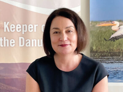
1994 and entered into force on 22nd October 1998. The Contracting Parties to the Convention are Bosnia and Herzegovina, Bulgaria, Croatia, the Czech Republic, Germany, Hungary, Moldova, Slovakia, Slovenia, Serbia, Montenegro, Romania, Ukraine, and the European Union. In August 2022, for the first time, a woman became the Executive Secretary of the International Commission for the Protection of the Danube River (ICPDR) – Prof. Dr.-Ing. Birgit Vogel.

Jizera Mountains researchers in Podbaba

On 25th January 2024, a seminar Meeting of researchers in the Jizera Mountains was held in the conference centre of T. G. Masaryk Water Research Institute (TGM WRI) in Prague. It presented (mainly long-term) research projects implemented in the Jizera Mountains and focused on atmospheric precipitation, forest soils and forests, waters and their biota in recent decades, i.e. from peak acidification to current phenomena associated with climate change. However, no less important was the personal meeting of people who research, permanently work or live in the Jizera Mountains and are interested in the development of the situation in this area, as well as the final debate open to all.

Disappeared pond system in the lower Doubrava river

This article presents the results of research of the pond landscape development in the lower Doubrava river. The results are based on the interpretation of archival map documents and the current state of the site. On the map of the 1st military mapping (1764–1768), a system of thirteen ponds was recorded on the right bank of the Doubrava river. There were three ponds on the left bank of the Doubrava river. On the map of the 2nd military mapping (1836–1852), only four ponds were recorded on the right bank of the Doubrava river and only two ponds on the left bank of the Doubrava river. Of the historic pond system, only Koukalecký pond and a pond near Žehušice chateau have survived to the present day. On the 1st military mapping map, the total approximate area of the ponds was 449 ha, on the 2nd military mapping map it was 107 ha, and today only 0.91 ha.

Weisshuhn flume in Žimrovice

The CHMI Ostrava branch has repeatedly had the opportunity to measure water flumes, mostly during verification measurements of minimum residual flows, measurements for structural wear, or revision of flow measurement curves. As part of these measurements, it was a very valuable experience to get to know these undoubtedly very interesting waterworks, which are often also technical monuments. Part of these activities includ-ed measurements and subsequent modelling of Weisshuhn flume in Žimrovice. This article summarizes and comments on the partial results of these activities. One of the tasks was to determine the critical points in terms of water losses in the Weisshuhn flume. Although these phenomena do occur, the numbers are not significant, as illustrated by the results of measurements and modelling. Different types of devices were used for the measurements; mostly ADCP devices, namely RDITeledyne StreamPro, SonTek RiverSurveyor M9, and SonTek Teledyne RS5. MIKE 11.

Water infiltration will help with heat, drought, and floods

New predictions of climate change impacts in the Czech Republic show that rainfall will increase slightly in the future. However, in combination with the expected increase in temperature, evaporation will be higher, which will lead to long-term water shortage. Forecasts also say that rainfall will be distributed differently during the year, which in practice means that long periods of drought will alternate with sudden torrential rainfall. But this is nothing new. In the Czech Republic today, there is already a lack of water; it lies on the main European watershed, and we are therefore highly dependent on rainwater. In the past, unfortunately, we have modified cities and the countryside in such a way that rainwater was quickly diverted away – by channelling watercourses, by farming methods, and by creating sewers. Adaptation measures to climate change in the field of water management can significantly increase the sustainability of water resources, reduce the risk of floods, and ensure water even in times of drought.

Protected areas of natural water accumulation – their meaning in the current system of water environment protection

This article discusses the development, management, and use of the landscape in the form of a declaration of a Protected Area of Natural Water Accumulation (CHOPAV). It examines the importance of this method of protection in the water protection system under the requirements of the Water Framework Directive and other European directives which have been incorporated into the legislation of the Czech Republic. It looks at the possibilities of using this tool in water management to deal with problems caused by climate change. Based on the research and analysis carried out, the article recommends modifications to the CHOPAV regime and area modifications, as well as expansion to other sites.

Development of land use and impact on water resources of hydrogeological unit 4232 Ústecká syncline in the Svitava river basin

The research area of hydrogeological unit 4232 Ústecká Syncline in the Svitava river basin (Ústecká synklinála v povodí Svitavy) is an important area of underground drinking water sources. These resources are of the highest quality and among the most abundant resources in the entire Czech Republic. The development of land use is closely connected with the development of settlements and industry (textile) in the research area, which in their importance far exceeded the borders of the region. Gradual development created pressure on natural resources, especially water; the demands on the quantity of service and drinking water increased, while the quality of water was affected by industrial and agricultural pollution. Despite the observed decrease in population in the last twenty to thirty years, we can see the expansion of settlements, mainly due to new construction on agri-cultural land, which is slightly compensated by the expansion of permanent grasslands and forests. With regard to current and future climate change, this increase, together with a slight increase in water bodies, can be considered as a positive phenomenon.

Use of effect-based methods to assess surface water status

This article deals with the use of effect-based methods for the qualitative assessment of the state of surface waters in the context of Directive 2000/60/EC establishing the framework for Community activity in the field of water policy and the upcoming amendment to Directive 2008/105/EC on environmental quality standards. The implemented monitoring of priority substances and specific pollutants is not able to capture all sources of pollution that negatively affect surface water quality. Likewise, current practice does not allow a comprehensive assessment of mixtures, including emergent pollutants, metabolites, and transformation products of substances on water quality. Effect-based methods are a suitable tool for ecotoxi-cological evaluation of pollution, which considers all substances contained in the sample and possible effects of mixtures (synergistic effects). They thus provide important additional information for the results of the assessment of the state of surface water bodies.

Interview with prof. Ing. Pavel Pech, CSc., professor at the Czech University of Life Sciences Prague

the future be over water rather than oil and land? Why is he more afraid of genes than climate change? And is it better to build dams and large water reservoirs, or establish ponds, wetlands, and pools? What is his opinion on artificial intelligence? These are just some of the topics that I discussed with prof. Ing. Pavel Pech, CSc., long-time head of the Department of Water Resources and Environmental Modeling at the Czech University of Life Sciences (CULS). “I’m from Hnojárna,”* he says about himself with a smile, and it does not sound pejorative at all – after all, he is the founder of the Faculty of Environmental Sciences at CULS in Prague.

Looking back at the National Dialogue on Water 2023

After a four-year break caused by the covid pandemic, the National Dialogue on Water took place on 25–26th October 2023, this time in the Skalský Dvůr hotel in Vysočina. The event was organized by the T. G. Masaryk Water Research Institute, p. r. i. (hereinafter TGM WRI) in coop-eration with the Czech Scientific and Technological Water Management Company (Česká vědeckotechnická vodohospodářská společnost, z. s.) The main theme of the event was a comprehensive approach to the protection of drinking water sources. This topic was addressed by a large number of experts from the field of water management (118 participants), whether it was representatives of the Ministry of the Environment (MoE), Ministry of Agriculture (MoA), Ministry of Health, state-owned River Basin State Enterprises, the Czech Hydrometeorological Institute (CHMI), water authorities, operators of water supply and sewerage systems (VaK), mayors, private companies, hydrogeologists, and others.

Kozmice bird meadows and their importance for nature and landscape

Alluvial wetlands and alluvial meadows (often referred to as “wet” in the literature) are one of the types of habitats that, with the gradual develop-ment of the cultural landscape, suffered the greatest transformation and often complete disappearance; in the Czech Republic, the most significant transformation by the transfer to field crops together with land improvement peaked roughly in the 1970s. Discussions about the importance of wetlands have, however, been revived in different periods; the factors that trigger these discussions are mainly floods and drought, which is clearly indicated by the drought that started in 2015. In their name, alluvial wetlands and meadows indicate that they are situated in a river landscape and are in periodic or constant contact with the surface water of larger rivers and groundwater, including the hyporeal. It is therefore obvious that these landscape elements are at least locally important for the cycle of water and chemical substances in the river landscape.

Direct monitoring of water vapor from the free water level of the Vavřinecký pond and its influence on the hydrological balance

With increased average air temperature, there is an increase in water vapour from a water surface. Between 2020 and 2022, evaporation from the water surface was observed with a floating evaporimeter at Vavřinecký pond in the Central Bohemian region. A floating evaporimeter monitors evaporation from the water surface along with basic meteorological quantities directly on the surface of the water reservoir, so its results should be more accurate than calculations based on data from nearby meteorological stations. The results show that in all three years evaporation exceeded precipitation by more than 100 mm between April and September. However, the issue of the influence of small water reservoirs on the hydrological balance is a very complex topic, where the assessment of negative and positive effects is not always black and white and requires detailed investiga-tion.

Drought warning system and local threshold limits

Droughts and floods are extreme hydrological phenomena that are currently increasing in frequency due to the growing impact of climate change, and can have significant effects on our lives. Within the “PERUN” research project, an assessment of drought conditions and their development in the Czech Republic is being developed, along with the innovation of the warning system by the Czech Hydrometeorological Institute (CHMI). Drought is a natural phenomenon characterized by a gradual onset, long duration, and low dynamics, which requires a specific approach. The amendment to the Water Act introduces the obligation of regular reporting on drought and the establishment of a predictive service to be conducted by CHMI. Tools are being developed for long-term prediction of water resource conditions and a methodology for drought and water scarcity management plans. These plans aim to ensure water supply, protect the environment, and minimize the economic impacts. The decision-making body for issuing measures based on the drought plans is the Drought Commission, which operates at the regional level. The warning information is available on the HAMR web portal, which also displays local threshold limits for individual water resources.
Protected areas for surface water accumulation from a hydrogeologist’s the point of view – the effect of possible realization of surface water accumulation on hydrogeological conditions

Suitable areas for the accumulation of surface water have been defined in the Czech Republic, potentially serving mainly for the supply of potable water and for mitigating the adverse effects of floods and drought. The sites are listed in the General Scheme on the Accumulation of Surface Water, which was obtained by the Ministries of Agriculture and the Environment following the previous long-term territorial protection of prospective water reservoirs. Before any decision to build these reservoirs, it is necessary to assess the project from various points of view. This article presents an evaluation of selected sites from a hydrogeological point of view. Among other things, it deals with the analysis of the location of potential res-ervoirs in the hydrogeological environment, the effect on the quantity and quality of groundwater, and the potential impact on the used groundwater resources. After the construction of the reservoirs, the groundwater level of the shallow aquifer will rise, and consequently, groundwater storage will also increase. However, it is necessary to assess the sites individually; there are often potentially negative effects of future reservoirs on groundwater.

Study of stream morphological changes and its application in the design of environmentally acceptable channels

Climatic change is manifested in a number of places by significantly spatially localized torrential rainfall with a short duration, but with great inten-sity. One of the expected consequences of this type of precipitation is the occurrence of flash floods, characterized by a sharp rise from the value of the normal flow to the value of the peak flow and a rapid decrease again. The consequence of this type of short episodic floods is the initiation of morphological transformations in the beds of smaller and medium upland streams, often with devastating effects for the section of the watercourse channel. The article summarizes research on the formation and development of a scour hole in the section at the transition from a lined riverbed with fixed bed and banks to the riverbed with loose channel boundry which can be transformed morphologically in an uncontrolled manner. In this re-search, the main attention was paid to the formulation of a parametric model of the scour hole morphological development at the transition between a lined and an unlined channel. The results of this model can be used both to understand the hydraulic-morphological processes that occur at the site of a sudden river bed change, and for the practical design of restoration modifications to the river bed at the transition from a fully lined to an un-lined river bed without any protective measures, approaching the original pristine conditions.

Will summer flows in watercourses be a half lower by 2060?

The increase in potential evapotranspiration due to warming is quite often used as an indicator of ongoing and predicted changes in the hydrological balance. However, without assessing its effect in basins with different precipitation regimes, it is not correct to consider a change in potential evapo-transpiration as an increase in actual evapotranspiration or a decrease in runoff.

„Water Centre“

The research project of the Technology Agency of the Czech Republic SS02030027 „Water systems and water management in the Czech Republic in conditions of climate change“, whose guarantor is the Ministry of the Environment, tries to answer the question of whether we will continue to have enough quality water. Climate change and the associated drought, as well as human behaviour and demands threaten water, and solutions must be sought for the immediate future.

Application for the parametrization and automatic running of the HEC-HMS rainfall-runoff model

This article presents an application developed in the Czech Hydrometeorological Institute (CHMI) to support hydrologic modelling using the HEC-HMS model as the primary used rainfall-runoff model. The application enables group editing of selected parameters of the model schematiza-tion, automatic running of simulations, display of selected simulation results, and communication of the HEC-HMS
model with GIS and other selected models, e.g., HEC-RAS or MIKE 11. The application is designed to use only freeware and open source libraries and is capable of operating under both Windows OS and UNIX/Linux OS. This article briefly describes the current state of the application devel-opment and its functionality, even for readers without major IT background. Further development is outlined in the last part of the article. Further development of the application is aimed at higher support for hydraulic modelling at the level of communication between the HEC-HMS and HEC-RAS models, as well as at the level of automatic parameterization and launching of the HEC-RAS model and its communication with other tools, e.g. hydraulic model MIKE 11 or GIS post-processing of the results.

Atmospheric deposition as a possible source of surface water pollution (Results of the project, part 2. – polycyclic aromatic hydrocarbons)

From October 2020 to September 2021, in two forest micro-catchments in the Czech Republic, the quality of wet atmospheric deposition (bulk and throughfall) was monitored simultaneously with the surface water quality in the local watercourse, humus, and the moss species Pleurozium schreberi. An evaluation is presented of the 15 polycyclic aromatic hydrocarbons (PAHs) burden of the above-mentioned matrices. The first site was chosen in the Beskid Mountains in the Moravian-Silesian region, in the cadastre of the village of Bystřice in the upper basin of the Suchý stream (altitude 590 to 835 m a.s.l.). This area is affected by industrial activities. The second reference site was chosen in the Bohemian-Moravian Highlands near Košetice observatory (altitude 520 m a.s.l.).

Development of pond locations in the Polabí lowland since the mid-19th century – part 2 – Poděbrady region

This article presents the results of research on landscape changes in the Poděbrady region as part of the Polabí lowland, where there have been significant changes in the location of ponds. The area of all types of ponds (according to stability) makes up 3.17 % of the Poděbrady region. Ac-cording to their occurrence in the area in 1836/1852–2022, the ponds (or their parts) were divided into disappeared, continuous, and new. Disap-peared ponds have the largest representation – about 60 % of the total pond area according to stability. They are followed by continuous ponds, with the minimum area represented by new ponds. The historical or (more precisely) disappeared ponds were more robust than the present ones, i.e., they had a larger average size. Analyses show that almost three-quarters of the disappeared ponds have been replaced by arable land.

Fundamental revision of the Urban Waste Water Treatment Directive provokes conflicting reactions from European Union member states

Council Directive 91/271/EEC of 21st May 1991, the Urban Waste Water Treatment Directive (UWWTD), entered into force 32 years ago, which is a respectable age for a legal regulation. Since then, through the consistent implementation of its requirements, good results in water protection have been achieved in practice. Between 1990 and 2014, there was a reduction in the amount of pollutants in treated and discharged urban waste water for organic pollution expressed as BOD5 by 61 %, for total nitrogen by 32 %, and for total phosphorus by 44 %. The extensive support pro-vided to cities and municipalities from EU financial instruments as well as from national sources and the relatively strict application of sanctions have led, according to data published by the European Commission (EC), to the fact that currently 98 % of waste water in the EU is effectively collected and removed of and 92 % properly treated. Until now, the Directive’s requirements have primarily focused on centralized systems for the collection, removal, and treatment of waste water in agglomerations producing loads at the level of 2,000 population equivalent (PE) and more.

Juvenile fish assemblages – appropriate tool for monitoring of the ecological status

Aquatic organisms have a very good ability to reflect the conditions of the environment they live in and, therefore, they are often used to assess the ecological status of that particular environment. of juvenile fish assemblages (0+) represent an appropriate tool for monitoring the ecological status of watercourses as they show a very rapid response to changes in environmental conditions. The goal of this study was to assess assemblages of juvenile fish (0+) at 22 sites across the Czech Republic between 2019 and 2021.