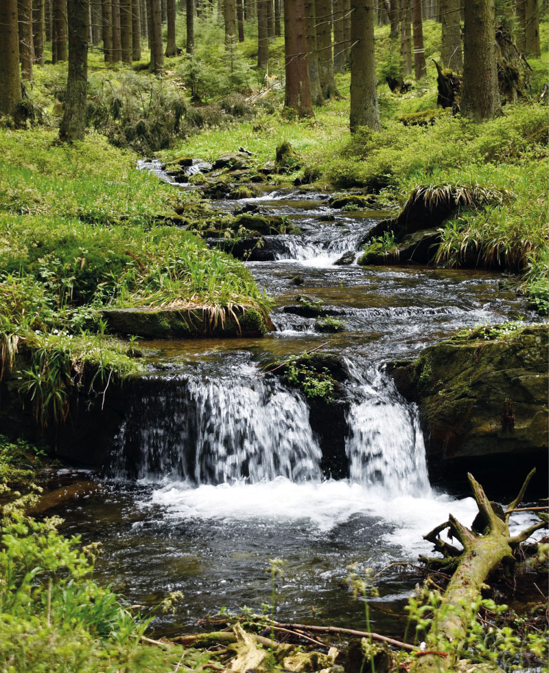
Verifying the applicability of methods for modelling erosion and connectivity of sediments in the Slavíč catchment in the Moravian-Silesian Beskydy mountains based on geomorphological mapping of fluvial processes
As part of the research activities of the Hydrology Department of CHMI Ostrava, field investigations and measurements are being carried out in several catchments to verify the outputs of GIS tools, empirical formulas, and mathematical models focused on surface runoff, fluvial erosion, and sediment transport. The main emphasis is placed on the influence of deforestation and land use changes on rainfall-runoff relations and fluvial erosion, especially within the framework of the NAZV “DEFOREST” and “CLIMCFOR” projects, in which CHMI collaborates with the Forestry and Game Research Institute (VÚLHM), the Bishopric of Ostrava-Opava, and Water Management Development, and Construction joint stock Company (VRV). The presented article deals with the possibilities of analysing fluvial processes and disconnectivity of flows in the Slavíč catchment in the Moravian-Silesian Beskydy Mountains. ESRI ArcGIS and GRASS GIS tools were used for these analyses. Field verification of outputs took place at several sampling points within the main stream Slavíč.
Weisshuhn flume in Žimrovice
The CHMI Ostrava branch has repeatedly had the opportunity to measure water flumes, mostly during verification measurements of minimum residual flows, measurements for structural wear, or revision of flow measurement curves. As part of these measurements, it was a very valuable experience to get to know these undoubtedly very interesting waterworks, which are often also technical monuments. Part of these activities includ-ed measurements and subsequent modelling of Weisshuhn flume in Žimrovice. This article summarizes and comments on the partial results of these activities. One of the tasks was to determine the critical points in terms of water losses in the Weisshuhn flume. Although these phenomena do occur, the numbers are not significant, as illustrated by the results of measurements and modelling. Different types of devices were used for the measurements; mostly ADCP devices, namely RDITeledyne StreamPro, SonTek RiverSurveyor M9, and SonTek Teledyne RS5. MIKE 11.