
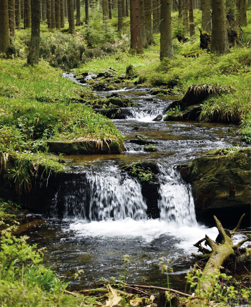
Measurement and modelling of changes in the runoff regime following calamitous decay and regeneration of forest stands in small catchments in the Jeseníky Mountains
The article presents partial results of monitoring and modelling in the experimental forest catchments of Suchý, Sokolí, and Slučí streams, the right-handed tributaries of the Černá Opava in the Jeseníky PLA. These results have been generated since 2022 thanks to the NAZV project No. QK22010189 “The impact of deforestation on the water regime of small river basins” with the working title DEFOREST, which also evokes the main goal of the project; to try to capture changes in the dynamics of stands (decay, controlled and spontaneous succession, etc.) and in the runoff regime of these river basins with regard to bark beetle outbreak and the subsequent damage clearing. In all these experimental river basins, monitoring of selected hydrological regime elements (e.g. precipitation on the open area, under-canopy precipitation, volumetric soil moisture, snow gauge sensors) was established, including stationary measurement of water levels in the closing profiles of all three sub-river basins. For modelling of stand changes and hydrological response to these changes, forest stand models (including the self-developed DEFOREST application) and hydrological models HEC-HMS, SIMWE, MIKE SHE and SWAT were used. The extreme flood in September 2024 largely destroyed the water gauging stations and remodelled the watercourse beds, so in 2025 the project team will focus on restoring monitoring.

Czech Copernicus User Forum and Remote Sensing Conference 2024 and the opening of Czech Space Week 2024 with participation of the President of the Czech Republic
In November 2024, a conference was held focused on the use of satellite data, organized by the Czech Hydrometeorological Institute (CHMI) and the Ministry of Transport (MoT), under the auspices of the President of the Czech Republic, who delivered the opening speech. In addition to expert workshops and panel discussions, the conference also featured several interesting contributions from the Transport and Environment Ministries, which illustrated the real-world use of remote sensing data in applications focused on ecological burdens and hydrological forecasting, as well as climate change, transport monitoring, and landscape planning. One of the most important conclusions of the conference is the confirmation of the importance of remote sensing data in the daily work of not only state institutions, but also commercial companies. These data give us the spatial context of selected natural phenomena and processes that would be monitored only partially or not at all without these data.
Verifying the applicability of methods for modelling erosion and connectivity of sediments in the Slavíč catchment in the Moravian-Silesian Beskydy mountains based on geomorphological mapping of fluvial processes
As part of the research activities of the Hydrology Department of CHMI Ostrava, field investigations and measurements are being carried out in several catchments to verify the outputs of GIS tools, empirical formulas, and mathematical models focused on surface runoff, fluvial erosion, and sediment transport. The main emphasis is placed on the influence of deforestation and land use changes on rainfall-runoff relations and fluvial erosion, especially within the framework of the NAZV “DEFOREST” and “CLIMCFOR” projects, in which CHMI collaborates with the Forestry and Game Research Institute (VÚLHM), the Bishopric of Ostrava-Opava, and Water Management Development, and Construction joint stock Company (VRV). The presented article deals with the possibilities of analysing fluvial processes and disconnectivity of flows in the Slavíč catchment in the Moravian-Silesian Beskydy Mountains. ESRI ArcGIS and GRASS GIS tools were used for these analyses. Field verification of outputs took place at several sampling points within the main stream Slavíč.
Weisshuhn flume in Žimrovice
The CHMI Ostrava branch has repeatedly had the opportunity to measure water flumes, mostly during verification measurements of minimum residual flows, measurements for structural wear, or revision of flow measurement curves. As part of these measurements, it was a very valuable experience to get to know these undoubtedly very interesting waterworks, which are often also technical monuments. Part of these activities includ-ed measurements and subsequent modelling of Weisshuhn flume in Žimrovice. This article summarizes and comments on the partial results of these activities. One of the tasks was to determine the critical points in terms of water losses in the Weisshuhn flume. Although these phenomena do occur, the numbers are not significant, as illustrated by the results of measurements and modelling. Different types of devices were used for the measurements; mostly ADCP devices, namely RDITeledyne StreamPro, SonTek RiverSurveyor M9, and SonTek Teledyne RS5. MIKE 11.
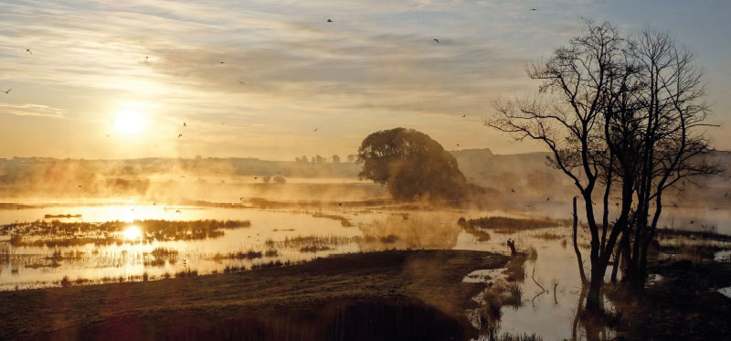
Kozmice bird meadows and their importance for nature and landscape
Alluvial wetlands and alluvial meadows (often referred to as “wet” in the literature) are one of the types of habitats that, with the gradual develop-ment of the cultural landscape, suffered the greatest transformation and often complete disappearance; in the Czech Republic, the most significant transformation by the transfer to field crops together with land improvement peaked roughly in the 1970s. Discussions about the importance of wetlands have, however, been revived in different periods; the factors that trigger these discussions are mainly floods and drought, which is clearly indicated by the drought that started in 2015. In their name, alluvial wetlands and meadows indicate that they are situated in a river landscape and are in periodic or constant contact with the surface water of larger rivers and groundwater, including the hyporeal. It is therefore obvious that these landscape elements are at least locally important for the cycle of water and chemical substances in the river landscape.
Application for the parametrization and automatic running of the HEC-HMS rainfall-runoff model
This article presents an application developed in the Czech Hydrometeorological Institute (CHMI) to support hydrologic modelling using the HEC-HMS model as the primary used rainfall-runoff model. The application enables group editing of selected parameters of the model schematiza-tion, automatic running of simulations, display of selected simulation results, and communication of the HEC-HMS
model with GIS and other selected models, e.g., HEC-RAS or MIKE 11. The application is designed to use only freeware and open source libraries and is capable of operating under both Windows OS and UNIX/Linux OS. This article briefly describes the current state of the application devel-opment and its functionality, even for readers without major IT background. Further development is outlined in the last part of the article. Further development of the application is aimed at higher support for hydraulic modelling at the level of communication between the HEC-HMS and HEC-RAS models, as well as at the level of automatic parameterization and launching of the HEC-RAS model and its communication with other tools, e.g. hydraulic model MIKE 11 or GIS post-processing of the results.