ABSTRACT
In November 2024, a conference was held focused on the use of satellite data, organized by the Czech Hydrometeorological Institute (CHMI) and the Ministry of Transport (MoT), under the auspices of the President of the Czech Republic, who delivered the opening speech. In addition to expert workshops and panel discussions, the conference also featured several interesting contributions from the Transport and Environment Ministries, which illustrated the real-world use of remote sensing data in applications focused on ecological burdens and hydrological forecasting, as well as climate change, transport monitoring, and landscape planning. One of the most important conclusions of the conference is the confirmation of the importance of remote sensing data in the daily work of not only state institutions, but also commercial companies. These data give us the spatial context of selected natural phenomena and processes that would be monitored only partially or not at all without these data.
INTRODUCTION
The topic of remote sensing (RS) has recently been increasingly associated with environmental issues. Copernicus is the European Union Earth observation programme which uses data from its own fleet of satellites called Sentinels. These satellites provide high frequency and precise data on the Earth’s surface, atmosphere, oceans, and climate. The programme offers valuable information not only for scientific research, but also for practical applications, such as monitoring air quality, deforestation, urbanization, changes in the marine environment, and for crisis management in the event of natural disasters. Copernicus data is freely available, which supports its broad use across sectors from public administration to commercial use. More information can be found at: https://www.copernicus.eu/en
Copernicus has several important hydrological applications, not only at CHMI:
- Flood and drought monitoring:
Data from the programme is implemented into GIS analyses, rainfall-runoff and hydraulic models, and helps predict extreme hydrological events and minimize their impacts through early warning and crisis management planning. - Water resource monitoring:
The programme contributes to accurate analysis of the state of surface and groundwater, which is key to sustainable water management. - Water quality management:
The Sentinel system allows monitoring of pollution in watercourses, lakes and seas, which is essential for protecting the environment and human health. - Support for modelling the impacts of climate change scenarios:
Copernicus provides input data for hydrological and environmental models that serve to better understand the dynamics of water systems, ecosystems, and the impacts of climate change.
National Secretariat of GEO/Copernicus (NSGC)
The Ministry of the Environment of the Czech Republic (MoE), in accordance with the Resolution of the Government of the Czech Republic No. 303 of 19 April 2017, established and manages the interdepartmental working body, the National Secretariat of GEO/Copernicus. The Secretariat is a permanent coordinating, initiating, and advisory body of the Minister of the Environment and members of the National secretariat of GEO/Copernicus and its partners, as well as the international Group on Earth Observations (GEO) initiative and other related space activities. The mandate and main activities of the National Secretariat are determined by its statute. Its main objective is to coordinate GEO and Copernicus activities in the Czech Republic, ensure the implementation of both programmes, and generally support the use of Copernicus data and services in the Czech Republic. From January 2024, the coordination of this agenda falls under the CHMI.
Conference history
As part of the promotion of RS activities and the Copernicus programme, a conference has been organized annually in the Czech Republic since 2012, previously under the name GMES (Global Monitoring for Environment and Security). Today, this programme is known only as Copernicus.
2024 Conference
The Czech Copernicus User Forum and Remote Sensing Conference 2024 took place on 4–5 November in the Fanta Building in Prague. The main organizers were CHMI and MoT. Before the conference itself, an event on space activities in the Czech Republic was held – Czech Space Week 2024 (CSW). Among other things, the Czech President Petr Pavel said that: “Space exploration and the space industry are exactly the sector that I am convinced that the Czech Republic should pay great attention to. It is an area with high-quality technology, high added value, and huge potential not only for the Czech Republic, but also for international cooperation.”
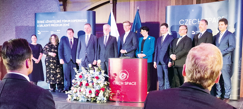
Meeting of experts under the auspices of the President of the Czech Republic took place at Fant’s Café in Prague (photo: A. Beránková)
First day of the conference
The first day of the conference was divided into five parts:
- Outlook for European Earth Observation Programmes 2025+
This part featured presentations on the possibilities of participating in InCubed programmes in the Czech Republic under the auspices of the European Space Agency (ESA). One example was the ongoing SKAISEN programme, which is run by the start-up ZAITRA. - Copernicus Academy
This part presented the activities of the Copernicus Academy network, which connects universities, research institutions, and other entities. The possibilities of education, research, and cooperation in the field of RS were discussed. There were also presentations from Czech universities, for example on selected approaches for detecting the cooling effect of urban vegetation using RS (Palacký University), the use of Sentinel-1 data and machine learning for forest monitoring (Charles University) and others. - Remote sensing at the Czech Hydrometeorological Institute and departmental organizations of the Ministry of the Environment
This part included the following topics – presentation of the third-generation Meteosat satellite system (CHMI), use of spatial data for inspection activities of the Czech Environmental Inspectorate (CEI), analysis of river basin runoff conditions and use of RS data (CHMI). In this case, it was the use of satellite data in forest hydrology and also for verification and calibration of hydraulic models simulating the course of the September floods in the Opava, Bělá, and Vidnávka river basins. - Panel discussion on digital twins
The panel discussion, chaired by Ondřej Šváb from the MoT, focused on the role of digital twins in the Czech Republic. The concept of a digital twin has established itself in industry, where it includes simulations of the production and life cycles of machines or components; however, it is also being used in environmental applications. An example is the digital twin Earth-2 from Nvidia. - Promising applications of Earth observation
It is clear not only from the presentations and workshops at the seminar that the use of RS in environmental applications already has a firm place in the research sphere and in operational practice. In the Czech Republic, this data is used on a daily basis in the departments of transport, security or the environment. This includes not only monitoring short-term phenomena (weather, floods, fires, slope deformations and movements or traffic collapses), but also long-term ones (changes in forest health, changes in land use or volumetric and qualitative changes in water bodies or glaciers).
Each part offered a unique perspective and contribution to the issue, allowing everyone to find what interests them.
Second day of the conference
The second day of the conference was designed as an international half-day workshop organized by the Copernicus Atmosphere Monitoring Service (CAMS). A total of 82 participants discussed the use of data for monitoring and forecasting air quality in the Czech Republic.
Richard Engelen from the European Centre for Medium-Range Weather Forecasts (ECMWF) presented the Copernicus Atmosphere Monitoring Service (CAMS), its architecture and innovations in atmospheric data modelling, including improvements to aerosol analysis and reanalyses at the global and European levels. A new version of the system was also presented, with improved chemical schemes and tools for data visualization and analysis.
Cristina Ananasso from ECMWF explained the functioning of the National Cooperation Programme (NCP), which helps Member States implement and adapt CAMS data at the national level. Subsequently, Thomas Popp from the Deutsches Zentrum für Luft- und Raumfahrt (DLR) presented the results of interviews with Czech CAMS users, which showed specific applications for air quality assessment and smog warnings.
The workshop also opened a discussion on the possibilities for improving the modelling of atmospheric transport of Saharan dust and other challenges associated with air pollution forecasting.
An informative article that is not subject to peer review.
